Why the Noon Rule in Colorado Is Not Just a Suggestion
Heading above treeline in summer? Treat noon as a hard weather deadline, not a casual suggestion. Colorado”s high country can look calm at breakfast and turn hostile before lunch. Solar heating destabilizes the air, rising currents build quickly, and isolated clouds can become lightning producers while you are still debating the next switchback.
“Start early” is useful advice, but it is too vague for a serious 14er day. A 5:30 or 6:00 AM departure may sound early and still leave you exposed when storms begin developing. The safer framework is a disciplined 4:30 AM start, a fixed treeline schedule, and a turnaround rule that does not change because the summit is close. Before leaving Rocky Mountain National Park lightning guidance, understand the central point: no outdoor location is completely safe during a thunderstorm, and exposed alpine terrain gives you very little margin.
The 4:30 AM Alpine Timeline from Trailhead to Safety
A 4:30 AM start does not guarantee safety. It creates usable time. You still need a route-specific plan based on distance, elevation gain, trail conditions, fitness, and the forecast. For a typical long 14er objective, the goal is to move through the lower forest in darkness, reach or approach treeline during the cool morning hours, summit before convection becomes organized, and be descending well before the sky becomes questionable.
Use the following timeline as a planning model, not a promise. A fast climber on a short route may move earlier through each checkpoint. A large group, loose terrain, high winds, altitude symptoms, or lingering snow can slow progress. Your schedule must include time to turn around, descend carefully, and reach lower terrain. Summit time is not the finish line. Getting below treeline is the real objective.
| Time | Decision Point | Required Action |
|---|---|---|
| 4:30 AM | Trailhead departure | Headlamp on, layers ready, route and forecast confirmed |
| 6:30 AM | Lower route check | Assess pace, altitude symptoms, wind, and cloud development |
| 8:00 AM | Treeline target | Reach treeline or establish a clear reason to turn back |
| 9:30 AM | Summit decision | Continue only with stable skies and adequate descent time |
| 10:00 AM | Hard turnaround | Reverse direction regardless of summit distance |
| 11:30 AM | Lower terrain goal | Be below treeline or moving decisively toward safer terrain |
Set a hard turnaround time before leaving the vehicle. For many exposed summer routes, 10:00 AM is a conservative benchmark. On a stormy monsoon day, it may need to be earlier. If you are still climbing toward the summit at the turnaround time, stop climbing. Summit fever is not a weather strategy. Neither is the thought that the clouds look harmless from the next ridge.
Build three separate criteria into the plan. First, turn around at the clock time. Second, turn around when clouds begin building vertically, even if the clock looks favorable. Third, turn around when pace, visibility, wind, or route-finding deteriorates. A good plan also identifies bailout terrain in advance. Mark the nearest treeline, broad low-angle descent, shelter, vehicle access, and alternate route. The best decision is the one made before fatigue narrows your judgment.
Reading the Sky: Benign Cotton Puffs Versus Explosive Updrafts
Not every cloud is a thunderstorm. Small cumulus humilis clouds often appear as rounded, white cotton puffs with relatively flat bases and limited vertical growth. They may drift across a blue sky without becoming dangerous. The key is not the cloud”s existence. Watch its rate of growth, shape, darkness, direction, and relationship to nearby terrain.
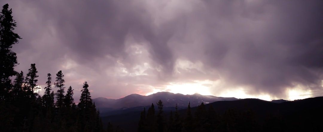
A developing storm grows upward faster than it spreads. Its edges become sharply defined. The base darkens. The top rises into a tall, cauliflower-like tower. In the next stage, the upper cloud can spread into an anvil or a fibrous ice shield. Mountains may hide the full anvil, so do not wait for a perfect textbook shape. If you can see only a high, frayed veil above a ridge, the storm may already be close enough to dictate a descent.
Give yourself a ten-minute observation window when conditions first look questionable. Take a photo or note the cloud height, then reassess. If the tower is visibly taller after ten minutes, treat that growth as a decision trigger. Do not use the observation period to climb farther from safety. Keep moving toward lower terrain while you evaluate.
- Flat, shallow bases with little vertical growth can indicate ordinary fair-weather cumulus.
- Rapidly rising cauliflower towers signal strong upward motion.
- Dark bases, gray curtains, or falling virga suggest precipitation and changing outflow winds.
- An anvil or high fibrous ice shield means the storm may be nearby even if rain is not falling on your route.
- Sudden cold air, sharp gusts, shifting valley winds, or electrical crackling demand immediate caution.
- Distant thunder counts as a warning. You do not need rain overhead to be at risk.
Use your body as a weather instrument, but do not rely on it alone. A sudden temperature drop can arrive with storm outflow. Wind may reverse direction as air descends from a neighboring basin. The valley breeze can strengthen or become erratic. These changes often arrive before the main rain shaft. When several signs appear together, stop debating whether the storm will hit your exact peak. Descend.
The Tactical Descent Protocol When Thunder Cracks Above Treeline
The first rumble is not a signal to finish one last photo. It is a command to change objectives. Leave the summit, ridge, arete, isolated boulder, and open slope immediately. Put distance between yourself and high points. Do not run blindly through loose terrain, but do not continue upward while hoping the storm passes.
- Tell every member of the group to descend. Use a clear voice and assign one person to lead while another watches the rear.
- Move off ridgelines and broad open slopes. Choose the safest route toward treeline, not necessarily the shortest route.
- Separate from metal objects such as trekking poles, ice axes, and large frames when practical, but do not waste time unpacking or abandoning essential gear.
- Avoid water, wet rock, fences, cables, summit structures, and isolated trees.
- Once below treeline, move toward the base of a uniform cluster of shorter trees or another lower, dry depression.
- If thunder continues, shelter in place and wait at least 30 minutes after the last thunder before resuming travel.
Terrain management matters. A gully can lower your profile, but a narrow drainage may become a flash-flood channel or a rockfall trap. Select a broad, dry, stable depression with no overhead hazard when possible. Avoid gullies filled with loose blocks, steep wet slabs, or active runoff. If the safe descent requires crossing exposed terrain, choose the route that reduces time in the open and keeps spacing between hikers.
The lightning crouch is not a magic shield. It is a last-resort posture when you are caught in exposed terrain and cannot reach safer ground. Separate group members, crouch low with feet together, minimize contact with the ground, and keep away from one another. Do not lie flat. Below timberline, a uniform stand of trees is generally preferable to standing alone beneath the tallest tree. A vehicle or substantial building remains better shelter than any outdoor position.
Caves and rock overhangs also require judgment. A small, wet cave or shallow recess can concentrate electrical current and create additional hazards. Do not crowd against walls or sit in flowing water. Follow official guidance from the National Park Service lightning safety page, which emphasizes descending below treeline and seeking lower, safer terrain rather than treating an exposed rock shelter as guaranteed protection.
How Monsoon Surges Warp Your Summer Safety Margin
Colorado”s summer weather is not static. The North American Monsoon typically strengthens in July and continues through August as moisture moves north from the Gulf of California and the eastern Pacific. The Colorado Climate Center”s monsoon overview notes that dew points can rise from the dry 30s or lower into the upper 40s and 50s. That extra moisture provides more fuel for heavy showers, stronger storm growth, and sudden outflow.
Monsoon conditions often arrive in bursts and breaks. A clear morning does not erase an active regional pattern. In western Colorado and eastern Utah, monsoonal influence commonly begins around the second week of July, though timing varies. Southern and southwestern Colorado usually feel the signal more strongly than the northeast. Moisture can also turn a lightning problem into a flood problem, especially in steep, narrow, recently burned, or already saturated terrain.
- Check the National Weather Service point forecast for the exact trailhead, summit area, and nearby ridges.
- Review hourly precipitation and thunderstorm probabilities, not just the daily high temperature.
- Look at dew point and precipitable moisture trends when available.
- Check radar before leaving and again at the trailhead, recognizing that mountain radar coverage can be limited.
- Read the forecast discussion when the pattern is unstable or the route is remote.
- Move your start earlier, shorten the objective, or cancel when storms are forecast to develop unusually early.
Do not assume the familiar 1:00 PM storm cycle applies every day. Moisture can shift meaningful storm development toward late morning, and localized cells may form earlier over high terrain. A broad regional weather app can flatten these differences. Use a specialized point forecast, then compare it with the actual sky. When forecast and observation disagree, respect the more dangerous signal.
Own Your Treeline Window and Live to Hike Another Peak
The mountain does not reward stubbornness. Above 11,500 feet, your physical margin is narrow, your route options shrink, and a storm can remove visibility and warmth in minutes. A summit success that leaves you exposed during the return is not a successful day. The experienced move is often the quiet one: turn around early, descend steadily, and arrive at the trailhead with energy left for the drive home.
Make the process automatic. Pack for cold rain and wind even when the forecast looks warm. Set the alarm for a real 4:30 AM departure, not an optimistic one. Tell a reliable contact the route and turnaround time. Recheck the sky at every major checkpoint. Then act when the plan says to act.
- Pack a charged phone, backup battery, map, headlamp, rain shell, insulating layer, food, and water.
- Write the turnaround time on a note or store it in a group member”s phone.
- Identify treeline, bailout routes, vehicle access, and flood-prone terrain before starting.
- Watch cloud bases and vertical growth during every break.
- Descend at the first credible sign of thunderstorm development.
- Reach safer terrain, spread out, and wait at least 30 minutes after the last thunder.
That is not overcaution. It is competent mountain travel. Discipline protects your trail time, your partners, and your chance to stand on the next peak. Make the gear check, own the clock, read the sky, and choose home base before the mountain makes the decision for you.